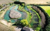
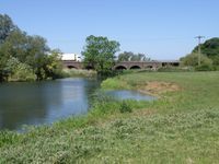
River
Denford Cutting
River conditions at Denford Cutting are level recorded. Level: 32.116m at LOWER RINGSTEAD SLUICE AUTOMATION WITS. Wind: 12 km/h NW. Source: LOWER RINGSTEAD SLUICE AUTOMATION WITS (EA) and Open-Meteo.
Last updated:
LOWER RINGSTEAD SLUICE AUTOMATION WITS
Level 32.116 m· stable
Measured river level from the nearest gauge.
Nearest gauge: LOWER RINGSTEAD SLUICE AUTOMATION WITS · 2.4 km away
12kph
Wind
10°C
Air temp
12.8mm
Rain (24h)
Compared to normal: Measured at the nearest gauge, stable
River Gauge
The nearest river gauging station shows the current level and whether it's rising or falling. This network doesn't publish a typical range, so we can't say if that's high or low for normal. Check the distance below to judge how relevant it is to your spot.
Level — last 7 days
Measured at the nearest gauge — not necessarily your exact spot. Source: LOWER RINGSTEAD SLUICE AUTOMATION WITS (EA)
Current Conditions
32.116m →
Measured level
13.2mm
Rain (7 day)
0
UV Index
10°C
Air temp
7-Day Forecast
Conditions change fast. Check local guidance and swim within your limits.
On the ground right now?
Share what you're seeing. Your conditions report helps other swimmers decide whether to go.
Share conditionsFrequently asked questions
Where does the river level and flow come from?
In England we show measured level (and flow, where recorded) from the nearest Environment Agency station; in Scotland (SEPA) and Wales (NRW), the nearest station with level + trend. Either way it is a real sensor in the river, updated through the day — we name the station, how far away it is, and link to its source page. It is a reading from the nearest gauge, not necessarily the exact spot you swim.
What do "normal", "high" and "low" level mean?
Each gauging station publishes its own typical range. We compare the latest reading to that station's range — so "high" means above what is typical for that river at that point, not a one-size-fits-all threshold.
Why does recent rainfall matter?
Rain in the catchment increases river levels and flow, sometimes hours or days after it falls. Heavy rain can also wash debris into the river and reduce clarity. Where there is no nearby gauge, recent rainfall is the best signal we can show.
What if there is no nearby gauge?
Measured gauge data covers the UK — England (Environment Agency), Scotland (SEPA) and Wales (NRW). Outside the UK, or where no station is within range, we show recent rainfall (the best simple guide to river levels) and say so plainly — we do not estimate a flow figure.
How do I read the level trend?
Rising levels mean more water is entering than leaving — conditions may get more challenging. Stable levels are predictable. Falling levels usually mean improving conditions, but be aware of what caused the rise.
What about weirs?
Weirs create dangerous recirculating currents that can trap even strong swimmers. Never swim near weirs — always give them a wide margin.