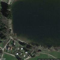
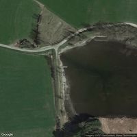
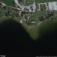
Photos of Bayersoiener See, Bad Bayersoien
Today at Bayersoiener See, Bad Bayersoien
7–12°C
ColdCold water ahead. Cold shock is a real risk on entry. Limit your time in.
Modelled from recent air temperature — the band's width is ours, not a published error figure · the label is our plain summary of the numbers, not advice
Before you go
Read before you swim
Reviews
No reviews yet. Be the first to share your experience.
Write a reviewAbout
Explore this spot near Bad Bayersoien. Great spot for swimming and paddling, boating, kayaking and canoeing. Bad Bayersoien is a municipality located in the Oberbayern region of Bavaria, Germany. The area is known for its beautiful natural scenery, including the nearby Soien See lake and the stunning Ammergau Alps mountain range. The town itself is situated in a valley surrounded by rolling hills and forests, with traditional Bavarian architecture visible throughout. The area is popular with hikers, bikers, and outdoor enthusiasts due to its extensive network of trails and scenic vistas. In addition, Bad Bayersoien is well-known for its spa facilities, which offer visitors a rejuvenating retreat in a picturesque setting. Overall, the area around Bad Bayersoien offers visitors a perfect blend of natural beauty, outdoor adventure, and cultural charm.
Location
What swimmers say
Activities
Water sports
Help verify this spot
Sign in to help verify details about this spot.
Been here recently?
Share conditions, tips, or hazards to help other swimmers plan their visit to Bayersoiener See, Bad Bayersoien.
Share an updateFor beaches, lidos, cafés, saunas and swim venues
Run Bayersoiener See, Bad Bayersoien, or a café, sauna or club beside it?
Every swimmer at your spot asks the same question: how’s the water today? A free poster or a live screen answers it — and brings your swimmers into a community that reports back.
- Completely free No fee for venues, no fee for swimmers. Print the poster, open the screen, and it runs itself.
- Wild Pro is optional Swimmers who want days two to seven of the forecast can subscribe — £3.99/mo or £29.99/yr. Today’s conditions and all official water quality are free for everyone, with no account.
- Safety first Water temperature, wind, waves, tides and the official bathing-water rating, shown plainly so people can decide for themselves.
- Live conditions Forecasts from Open-Meteo, tides from WorldTides, sea temperature from Copernicus Marine, and water quality from the agencies that test it.
- Built on community Swimmers post what they found. A poster or a screen at your spot turns every swim into a report the next swimmer can use.
Frequently asked questions
Is this lake safe for swimming?
Check the Conditions tab for surface state and wind conditions. Review the Quality tab if this is a designated bathing water. Always read recent community reports for local advice.
How cold is the water?
Check the Temperature tab for the current estimate and 7-day trend. Lakes hold heat longer than rivers but can develop a thermocline. The water below the surface can be dramatically colder.
What should I bring?
A tow float for visibility (especially important where boats operate), warm layers for after, and consider a wetsuit in colder months. Check for designated swimming areas.
What should I know before swimming here?
Cold water shock is real. Enter slowly and control your breathing. Lake water can be much colder below the surface (thermocline). Stay close to shore until you know the conditions. Watch for boat traffic and stay visible with a tow float. Check for blue-green algae warnings before swimming. Conditions change fast. Always check the latest data, read recent community reports, and swim within your ability.